Lets you perform accurate syntax checking tasks for HTML, XHTML, and CSS files.
Convert websites to several formats.
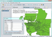
An open-source program that can read ESRI Shapefiles.
Plot geotagged images in a selected folder on a virtual globe
Allows you to insert any type of content, such as images, tables and much more.